Making Mérida’s Urban Landscape Viable
Learn about what took place during the workshop “Making Mérida’s Urban Landscape Viable” with Andrea Conde. This collaborative initiative aimed to rethink the city’s expansion and its surroundings from a landscape perspective, grounded in the historical, archaeological, and ecological knowledge of the region. An initiative guided by Dr Benjamín Vis.
A transdisciplinary workshop to imagine sustainable satellite cities grounded in the vernacular history of the landscape.

Conociendo el sitio (Komchén) / Getting to know the site (Komchén)
Fotografía / Photography: Rob Roggema
From June 18 to 27, 2025, an intensive workshop took place at the Universidad Autónoma de Yucatán’s Cultural Center (UADY), aimed at reimagining Mérida’s urban growth and its surrounding areas through a landscape perspective rooted in the historical, archaeological, and ecological knowledge of the territory. Titled Making Mérida’s Urban Landscape Viable: Vernacular Adaptive Land-Use Patterns for a Socioecological Life, the workshop brought together specialists from diverse disciplines, including urbanism, archaeology, architecture, anthropology, philosophy, and ecology.

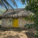
Archivo del sitio (Caucel) / Site archive (Caucel)
Fotografía / Photography: Rob Roggema
This initiative is part of a research project led by Dr Benjamín Vis (Université Libre de Bruxelles) funded by the European Union through the Marie Skłodowska-Curie Actions program for scientific excellence. The project explores long-term urban morphology in the region, identifying land-use patterns inherited from pre-Hispanic Maya agro-urban landscapes to inform contemporary sustainable urban design.

Visita al sitio / Site visit
Fotografía / Photography: Rob Roggema
The workshop followed the charrette methodology—an intensive, collaborative design process—applied in three of Mérida’s fast-growing satellite cities: Caucel, Kanasín, and Komchén. These places served as urban laboratories to explore how vernacular patterns and practices—such as the extensive use of patios, the organization of urban blocks, and the integration of agricultural and residential uses—can inspire innovative proposals rooted in contemporary indigenous urban logic.

Archivo del sitio (Kanasín) / Site archive (Kanasín)
Fotografía / Photography: Rob Roggema
The coordinating team included Esteban Martínez Hernández (INTBAU Cuba and Andrea+U Studio), Nahuel Beccan Ávila (BD+P Urbanism and Landscape and Xicalli Coliuhqui, an archaeology and urbanism studio), Arjan van Timmeren (TU Delft) and Rob Roggema (Tecnológico de Monterrey). The workshop also benefited from the participation of students, academics, and community representatives, as well as the support of key institutions including the Faculty of Architecture and the Faculty of Anthropological Sciences (UADY), the Embassy of Belgium in Mexico, UN-Habitat Mexico, the Secretariat of Agrarian, Territorial and Urban Development (SEDATU), the Institute of Mobility and Territorial Urban Development (IMDUT), and the municipalities of Mérida, Kanasín, and local commissioners.

Vista de la propuesta preliminar en Komchén / View of a preliminary proposal in Komchén
Visualización / Visualization: Ismael Pimentel

Vista de la propuesta en Komchén / View of the proposal in Komchén
Visualización / Visualization: Ismael Pimentel
The workshop addressed multiple scales of urban design:
- The solar (residential lot) and the Maya vernacular home as regenerative units;
- The urban block as a collective spatial fabric;
- The regional socio-ecological master plan for each satellite city;
- Expressing the evidence-base through a cultural and symbolic narrative of the Maya heritage landscape as a foundation for envisioning future urban forms with identity.

Mapeo a mano / Hand-drawn mapping
Fotografía / Photography: Andrea Conde
The proposals developed during the workshop aim to offer viable alternatives to the real-estate-driven urbanism that dominates the region currently. Instead, they advocate an urban growth model that embraces the continuity of the Maya landscape as a living source of social, ecological, and spatial innovation.
The workshop proposals advocate an urban growth model that embraces the continuity of the Maya landscape as a living source of social, ecological, and spatial innovation.

Mapeo urbano / Urban mapping
Fotografía / Photography: Andrea Conde

Benjamín Vis, Esteban Martínez Hernández, Rob Roggema y Anouk Roggema
Fotografía / Photography: Andrea Conde


-10.28.24.jpg "Anunciate07-13-a-la(s)-10.28.24")

 13.26.42.png "Captura de Pantalla 2023-02-08 a la(s) 13.26.42")